• About

Atlas of Ice and Fire

~ The geography and maps of George R.R. Martin's A Song of Ice and Fire and other fantasy worlds

Atlas of Ice and Fire

Category Archives: malazan atlas

A Malazan Bonus Map for The God is Not Willing

02 Friday Jul 2021

Posted by werthead in malazan, malazan atlas, steven erikson

≈ 1 Comment

Steven Erikson’s latest entry in the Malazan literary universe was published yesterday. The God is Not Willing is the first novel in the Witness Trilogy. Set ten years after the events of The Crippled God, the novel depicts the misadventures of the Malazan XIVth Legion as it is redeployed to the town of Silver Lake, the same town visited by Karsa Orlong many years earlier (in the first part of House of Chains), resulting in total chaos. The fallout from that visit is still being felt. Meanwhile, the Teblor tribes are on the move, preparing to move south in vast numbers to escape a coming natural disaster and seek out the Shattered God, Karsa Orlong, the God who is Not Willing.

A map of the Malyn Province of the Malazan Empire, located in the north-west of the continent of Genabackis. Please click for a larger version.

I reviewed the book last month, and I thought it might be fun to create a map for the area covered in the novel. I drew on the map in The God is Not Willing itself and also utilised the House of Chains map and Steven Erikson’s own map of the Blackdog region to create something that is hopefully quite interesting, and handy for those who wanted a larger-scale view of the events.

Thank you for reading The Atlas of Ice and Fire. To help me provide better content, please consider contributing to my Patreon page and other funding methods, which will also get you exclusive content weeks before it goes live on my blogs.

Advertisement

A New & Almost-Definitive Malazan World Map

04 Wednesday Mar 2020

Posted by werthead in ian cameron esslemont, malazan, malazan atlas, steven erikson

≈ 17 Comments

My longest continuous online mapping project has been an attempt to produce a semi-definitive map of the world of the Malazan saga by Steven Erikson and Ian Esslemont. I started trying to come up with crude world maps all the way back in 2005, and these have continued intermittently ever since, especially when the authors released new regional maps in the books.

This is a totally new, ground-up redrawing of the world map on a new and extremely large scale (apologies for those who have problems loading it).

World of the Malazan Empire

Please click for a much (much!) bigger version.

This map was created by combining the individual regional maps from the books with Steven Erikson’s original world map that he created back in the 1980s. Although that map was superseded by the later maps he created for the books with artist Neil Gower, it still proved extremely useful for the areas of the world that have still not appeared on any official map (such as Bael, western Seven Cities, Genostel and Umryg).

A few areas have survived from the older world maps created by D’rek on the Malazanempire forum, most notably Stratem. D’rek created the original outline of Stratem which I then modified when it became clear that the Sea of Chimes was virtually landlocked. Steven Erikson’s map of Korelri-Stratem wasn’t much help because it had been thoroughly revamped for the novels, so I kept Stratem much the same as in previous maps. It remains the only continental outline to be pretty speculative.

Other areas are still pretty speculative, such as most of western Seven Cities: we know where Perish, Nemil, Shal-Morzinn, Cabal, Ekhran, Grol Etur and Drammatan are located but not much more than that. The location of Farrog, Nightmaria and the Great Dry is also purely speculative.

Other locations are speculative in detail even when their general location is correct: Lamentable Moll, Spendrugle, Trygalle, Seven Ruins Island and the Glass Desert are all in the right general area, but their precise location may be slightly off.

globe (3)

As a bonus you can also see the map on a globe via this link.

As always, leave thoughts on the map in the comments and please let me know if you find any errors or mistakes.

Thank you for reading The Atlas of Ice and Fire. To help me provide better content, please consider contributing to my Patreon page and other funding methods, which will also get you exclusive content weeks before it goes live on my blogs.

Malazan Maps of the Fallen: Climate & Ice

17 Wednesday Apr 2019

Posted by werthead in ian cameron esslemont, malazan, malazan atlas, steven erikson, Uncategorized

≈ Leave a comment

One question that invariably arises when new maps of the Malazan world appear is how the climate works, since it clearly isn’t like our world. Deserts are present at unlikely latitudes and vast ice fields at even more unlikely latitudes.

Malazan World Map 2019 Deserts and Ice

A map of the Malazan world with deserts and forest areas highlighted. Please click for a larger version.


In the deep prehistory of the Malazan world, a mighty war was fought between a race of proto-humans known as the Imass and an Elder race known as the Jaghut. The Jaghut were masters of ice and cold magic, drawn from the Elder Warren of Omtose Phellack. During the war, which lasted hundreds of thousands of years, the Jaghut repeatedly created vast ice fields to throw the Imass off their hunt, creating huge icy redoubts where they could survive for millennia. However, the Imass chose to simply wait them out, undergoing the Ritual of Tellann to become the undead warriors known as the T’lan Imass.

Eventually most of the Jaghut were killed and the Imass disappeared, either destroyed or becoming dormant until summoned back to life by the rediscovery of the First Throne. But the immense ice fields left behind by the Jaghut remained, and these fields seem to have contributed to the strange climate of the Malazan world.

The largest ice fields are located in equatorial regions, on either side of the island-continent of Jacuruku, making travel to that landmass difficult and dangerous, and also sprawling across the north-western end of the Letherii continent. This last ice field is the most powerful, created by the Jaghut arch-sorcerer Gothos in the aftermath of a magical conflagration between the Tiste Edur and Tiste Andii, and seems to have had dramatic side-effects across the entire continent, disrupting at least the perception of time (so the records of the Kingdom of Lether show that 7,000 years have passed since the continent’s colonisation, rather than over 70,000 years) and freezing in place the use of the Holds as the primary form of human sorcery rather than the Paths (the younger Warrens).

A significant ice field is also located on Quon Tali, separating the main body of the continental landmass from the subcontinent of Falar to the north. A further field sprawls across the southern frontier of Korelri, just north of the Aurgatt Range, separating the subcontinents of Korelri and Stratem from one another. Further ice fields are located south of Seven Cities and west of Quon Tali (discouraging explorations of south-western Seven Cities from Quon Tali, which is probably a good thing due to the presence of the fiercely isolationist Shal-Morzinn Empire). These are, of course, only the major ice fields left behind by the Jaghut. Much smaller ice fields, often indistinguishable from mundane glaciers, are located right across the globe, from Assail to northern Genabackis.

The ice fields are one part of the equation. The other oddity is the presence of large deserts – the Bandiko and Otataral – at a very northern latitude on Otataral Island, and the presence of numerous areas of scrubland, border-desert and wastelands, collectively known as odhans, sprawling across eastern Seven Cities, also much further north than you’d expect (especially given Seven Cities’ numerous inland seas, lakes and lengthy rivers). The answer seems to lie in a number of mysterious, gigantic statues built of an unknown jade-coloured material. These Jade Statues arrived on Otataral Island tens of thousands of years ago and seem to have turned the island dead, destroying the natural wildlife and creating the magic-deadening ore also called otataral. The disruptions to the climate seem to have spread across neighbouring Seven Cities, which in the days of the First Empire seemed to be much greener and more verdant, the home to vast, sprawling cities and a tranquil inland sea. After the climate disruptions the land became blasted and sere, and the inland sea dried up to become Raraku, the so-called Holy Desert.

The Malazan world is thus still afflicted by the ruins of conflicts that raged three hundred thousand and more years ago. To the people of the world, these oddities are the norm and not worthy of much investigation. The question does arise, however, should the Jaghut rituals fail and the ice start melting, what will happen to the low-lying areas of the planet?

Thank you for reading The Atlas of Ice and Fire. To help me provide better content, please consider contributing to my Patreon page and other funding methods, which will also get you exclusive content weeks before it goes live on my blogs.

The New & Improved Malazan World Map

17 Wednesday Apr 2019

Posted by werthead in ian cameron esslemont, malazan, malazan atlas, steven erikson, Uncategorized

≈ Leave a comment

One of the most constant projects I’ve been working on for the past decade is the refining and improvement of a world map for Steven Erikson and Ian Esslemont’s Malazan series of epic fantasy novels. This led to the Malazan Maps of the Fallen series I ran in early 2018.

Malazan World Map 2019

The new, improved Malazan world map. Please click for a larger version.

I wasn’t expecting to revisit the Malazan setting so soon, but a few months ago Steven Erikson released his original Malazan world map from the 1980s on his Facebook page. Although many of the details of the map have changed since Erikson created the original (as seen in the maps in the books), the general shape of the world and landmasses remains the same. As such as, I was able to revisit the prior world map (created by D’Rek on the Malazanempire forum, although I moved and resized some of the landmasses and added new labels) and revise it. I also took this opportunity to redraw the entire map, as the previous one was not at high enough a level of resolution to mark in all the details required.

Steven Erikson’s original, hand-drawn map follows:

Original Malazan World Map

Steven Erikson’s original, 1980s Malazan world map

I made a fresh copy of this map for clarity. Again, it should be emphasised that Erikson drew this map in the 1980s, a clear decade and more before he published Gardens of the Moon, and it represents the world of Malaz at an earlier stage in its conception, hence “Leathers” instead of “Lether” and so forth.

Original Malazan World Map

A cleaned-up and clarified version of Erikson’s original map.

I then combined this map with the prior world map. Several judgement calls had to be made here, most notably because Erikson was using a rough, square base for his world map whilst I have been using a rectangle meant to reflect the dimensions of a spherical world. This mean some re-placement of landmasses to make more sense in a more realistic context.

Korelri/Stratem I left unchanged from the previous map. Erikson himself notes that the original conception of Korelri/Stratem had changed anyway (presumably as he’d passed it over to Esslemont to develop further) so it was in error on his original map. This means that we still don’t have a canonical map for Stratem (which remains the biggest anomaly in Malazan cartography), but a whole host of other problems were resolved, including canonical information on the shape of Bael, the western extent of Seven Cities and the location of Genostel and Umryg.

Some additional finessing was required: Lether is clearly larger and more stretched on an east-west axis in the book than on the original map, so I mostly retained the prior world map appearance. I did adjust the entire east coast of Lether (in the area of Estonbase and Kolanse) because the original was clearly incorrect. I also increased the size of Jacuruku. It is possible that Korelri/Stratem remains too large on the new map and should be taken down in size, but I await further information to see if that is warranted. One of the most interesting bits of new information was the existence of a southern polar continent, with a northwards extension between Assail and Lether.

For now, this is the most up-to-date and semi-canonical Malazan world map that exists. I await more information emerging from future books to see if it can be updated any further.

Thank you for reading The Atlas of Ice and Fire. To help me provide better content, please consider contributing to my Patreon page and other funding methods, which will also get you exclusive content weeks before it goes live on my blogs.

Malazan Maps of the Fallen 08: Assail

29 Sunday Jul 2018

Posted by werthead in ian cameron esslemont, malazan, malazan atlas, steven erikson, Uncategorized

≈ Leave a comment

Our exploration of the geography of Steven Erikson and Ian Esslemont’s Malazan world continues.

To the south of Genabackis and to the east of Korelri lies a landmass whose very name is rarely uttered. “Assail” is the most mysterious, the most enigmatic and the most foreboding of the world’s continents. It is not a remote continent, lying just a few weeks’ travel eastwards from Quon Tali across the Reacher’s Ocean and just a few days south of Genabackis across the Rivan Sea, but it is one that is studiously avoided by almost everyone.

Assail

The continent of Assail. Click for a larger version.

History

Little is known of Assail’s ancient history. The continent has a human population, so at one time the continent was likely settled by the First Empire (which is generally held to be responsible for the initial human diaspora across the planet), but beyond that the continent is also known to have pockets of Jaghut blood. It is believed that both the highly mysterious Forkrul Assail (who may have given the continent its name) and the K’Chain Che’Malle were also active on the continent in distant, past millennia.

In recent times, the continent has been effectively sealed off to travel. Almost all who travel there, particularly to the lands north of the Black Stone Mountains, fail to return. Rumours speak of Tyrants who control parts of the continent and the destruction of entire clans of the T’lan Imass. Rumours also speak of gold being found on the continent in significant quantities. Occasionally this sparks gold rushes, pirate fleets and mercenaries setting out to get rich. Again, almost none return.


Geography

Assail is a fairly large continent, more than two-thirds the size of Genabackis and larger than Quon Tali, perhaps rivalling the combined Korelri-Stratem continent in size (but still somewhat behind Lether and Seven Cities). Various sailors have attempted to chart its shores, with some success, although the inhospitable nature of those shores makes such attempts difficult.

It is known that the continent is divided into two distinct regions by the Black Stone Mountains. Everything to the north is Assail proper, a land of townships, city-states and fractious tribes. The lands to the south are known as Bael, which forms a distinct subcontinent. Bael is relatively hospitable and sometimes welcomes outsiders; Assail is unrelentingly hostile to visitors.


The North Coast

The northern coast of Assail sits south of Genabackis, just across the Rivan Sea, and is relatively accessible. However, the entire coast is uninhabited. From the Barren Coast in the west, stretching hundreds upon hundreds of leagues to the east, along the Plain of Ghosts, Plain of Visions, Plain of Sighs and the Wrack Coast, lies almost nothing. Barely any trees, no mountains and few sources of fresh water can be found. This is a lifeless and dreary land. According to rumour, one settlement can be found on the north coast, a hidden inlet or bay leading to a fortress called Fallen or Taken. If true, no reliable sailor has ever confirmed its location.


The West Coast

The western coast of Assail brushes against both Reacher’s Ocean and the Bloodmare Ocean, with the continent of Korelri located just a couple of weeks’ hard sail to the west. Again, the coast is mostly uninhabited, although nomadic tribes (of course, mostly unwelcoming and hostile) can be found just inland on the plains between the ocean and the Range of the Saints. In the south of this region can be found the Yag’Quarall, the Silent Tribes.

Curiously, the sailors of Mare in Korelri, despite claiming to be the greatest sailors in the world, refuse to cross the ocean to Assail, refusing to believe lands lie beyond the ocean.


The Wrecker’s Coast

The east coast of Assail is where what civilisation that is vaguely welcoming to foreigners can be found, although this is a very relative determination.

Once a ship turns south along the Plain of Longing, it enters the Sea of Hate, so-called because of the dangerously lethal currents and hidden rocks. If they survive to the enter the Bay of Timber, named for the once-abundant forests on its shores, they can find a relatively safe welcome at the port of Holly. From here, they can travel north across the Plain of Chance, in the shadow of the northern Bone Range, to the City of Many Saints on the shores of the inland Sea of Gold. Naturally, few who venture in that direction are ever seen again.

The south coast of the Bay of Timber and all the east coast as far as Talon Forest are known as the “Wrecker’s Coast”. Currents conspire to bring many wrecked ships to this stretch of water, resulting in wrecks and ruins from half the world accumulating along the shores. The people of this land are known as wreckers, as looting the ships for gold, weapons and booty to sell on to traders is highly lucrative. Towns along the coast, such as Rough Landing, Bones, Pillar and Widden, are wrecking posts from where crews set out to loot the ships brought to them by the ocean.


The Inland Seas

Halfway along the Wrecker’s Coast is a bay that leads to an inlet. This stretch of water – the Fear Narrows – is lethal and almost impassable due to the Guardian Rocks. These pillars of stone swirl the water into unpredictable currents that can smash boats to kindling with ease, whilst more rocks lie just under the water, ready to tear out the hulls of any ships that try to pass. Wrecked ships can be found all along the shore, adding to the chaos, and the coastlines are marked by tall cliffs.

If a ship should successfully run the gauntlet of the Fear Narrows, it might find shelter in the port of Old Ruse, although as many ships vanish after visiting Old Ruse as they do attempting to pass the Narrows.

Beyond Old Ruse the Narrows open into the Sea of Dread, a large inland sea. Formed of meltwater from what some mages theorise may be a Jaghut-created glacier, the sea is inherently magical. Unprotected sailors can fall into a torpor that eventually leads to death. Mages aware of this threat can erect defensive wards around their ships which permit safe passage across sea.

There are settlements on the Dread Sea. Second Landing and North are relatively ordinary, if somewhat isolated, ports. On the south coast is Exile Keep, run by two families involved in constantly feuding against one another. To the north is Mist, reportedly ruled by a powerful and capricious mage.

Further north lies the Sea of Gold, so called because it lies at the feet of the Blood and Salt ranges, reportedly the home of vast gold fields. The truth of this is hard to ascertain, as both the sea route through the Dread Sea and the overland route over the Plain of Chance from Holly are extremely hostile, and of the few who survive the journey far fewer (if any) ever successfully return).


Bael

Located at the southern end of the Assail continent, the lands of Bael are relatively welcoming compared to those of the rest of the continent. Bael is effectively separated from Assail proper by the Black Sea to the north-east and the large Black Stone Mountains to the north-west.

Bael is the home of a collection of tribesfolk who worship a deity known as Father Wind. Some of the inhabitants of Bael have abandoned their tribal lifestyle to found cities, such as Nabraji and Kurzan. Kurzan is the southern and eastern-most known safe port in the world; beyond it lies the vast and trackless deeps of the Domain Ocean which extend eastwards for thousands upon thousands of leagues before reaching the far western coast of the continent of Lether.

The tribes of Bael are known as the Yaguran or People of the Wind. They worship shamanic totem spirits as well as Father Wind, and engage in athletic competition and “friendly” raids on one another as demonstrations of aptitude. They are relatively friendly, but in recent decades have found their lands encroached on by the Nabrajans, who have started building garrisons on the plains to control sources of food and water A major conflict between the tribes and the city-builders seems likely.

Unlike northern Assail, Bael is relatively easily reached by ship across the southern Bloodmare Ocean from the east coast of Stratem.


Credits: Based on the original maps created by Neil Gower. Extrapolated by D’rek at the Malazanempire forum. Placements and names adjusted by myself. Based on the Malazan Book of the Fallen series, Kharkanas Trilogy and Witness Trilogy by Steven Erikson, and the Malazan Empire and Path to Ascendancy series by Ian C. Esslemont.


Thank you for reading The Atlas of Ice and Fire. To help me provide better content, please consider contributing to my Patreon page and other funding methods, which will also get you exclusive content weeks before it goes live on my blogs.

Malazan Maps of the Fallen 07: Jacuruku

28 Saturday Jul 2018

Posted by werthead in ian cameron esslemont, malazan, malazan atlas, steven erikson, Uncategorized

≈ Leave a comment

Our exploration of the geography of Steven Erikson and Ian Esslemont’s Malazan world continues.

Jacuruku is said to be the smallest of the world’s continents, although some instead claim it is the largest of the world’s islands. The continent is located west of Korelri, south-west of Quon Tali and far to the east of the Letherii continent. It is located in the White Spires Ocean, but its shores are also bordered by the Horn Ocean to the north and the Sea of Storms to the north-east.

The continent lies relatively close to the shores of western Korelri – in ancient times Jacuruku was called the “sister continent” of Korelri – but is separated from it by vast floes of ice. These ice floes make the continent almost impossible to approach from the east or north, forcing would-be visitors to swing far to the south and west instead. Given the relative isolationism of Jacuruku and the lack of resources on the continent, it is rarely visited and its peoples rarely visit other lands.

Jacuruku

A map of Jacuruku and the surrounding regions (ice floes not shown). Click for a larger version.

History

Early in its history, Jacuruku was colonised by the K’Chain Che’Malle. After their demise, Togg and Fanderay used the lush continent as their hunting grounds. After this time Jacuruku became home to the tall, physically powerful race known as the Thel Akai. When humans came to the continent is unclear, but it may have been in the earliest days of their history, before even the rise of the First Empire on Seven Cities. The Thel Akai, then in decline, tutored and mentored the humans. The Elder God Ardata arrived on Jacuruku at some point and became a ruler and deity to some of the human tribes.

It is known that, at some point, the human warrior, soldier and tactician Kallor Eidermann Tes’thesula arrived on Jacuruku (or may have been native to it; the histories and legends are entwined and confusing) and conquered the entire landmass in a fifty-year campaign. He even forced Ardata into submission. He slaughtered the Thel Akai when he realised they were helping his opponents stand against him. Styling himself the High King, Kallor established an empire spanning both Jacuruku and other landmasses, possibly including parts of neighbouring Korelri. He ruled over an empire of twelve million souls, seven million of them on Jacuruku. This took place approximately 121,000 years ago.

Kallor’s rule was harsh and tyrannical. A group of eight mages chose to stand against him. Known as the Circle, they joined together on the continent of Korelri to seek out a source of magic which could overcome and destroy Kallor. During their reachings, they found the entity known as Kaminsod, a god of another world in another universe altogether. They summoned Kaminsod through a rent or wound in space, believing his utterly alien sorcery could overcome the High King. They miscalculated. Kaminsod fell screaming to the earth as a vast fireball which shattered on impact, shattering Korelri and devastating a vast region. Kaminsod subsequently became known as the Crippled God. The destruction was immense, its reverberations shaking even the warrens.

Furious at the consequences of Kallor’s tyranny, the gods and Ascendants known as K’rul, Draconus and the Sister of Cold Nights joined their power to destroy him. However, Kallor had performed a ritual that burned the continent of Jacuruku down to its bedrock, killing all seven million inhabitants in the process. This mass-sacrifice empowered Kallor to resist the three gods; instead of killing him they cursed him to life unending, barring him from ever ascending and always living in failure. Kallor responded by cursing the three gods to different, unpleasant fates.

Rather than leave the continent uninhabitable, K’rul drew on his power to pour the ashes and ruins of the empire into a new warren (later claimed by the Malazan Empire to become the Imperial Warren), leaving behind an uninhabited wilderness which would recover given time. Fresh human settlers – some of them possibly from the now-devastated colonies on Korelri and perhaps others fleeing the growing chaos in the First Empire – landed on Jacuruku and settled it. A mageocracy took power in the north-west of the continent, also known as the Circle, possibly named in honour of the group that brought about the Fall of the Crippled God.

Whilst the mages assumed control of north-western Jacuruku, the goddess Ardata reasserted her domination of the jungle tribes of the east and independent tribesfolk arose in the desert wastelands of the south-west, resulting in a rough stalemate of power which – it is believed – has endured for thousands of years to the present day.


Geography

The continent of Jacuruku is small, but still large enough to enjoy a variety of different climates and landforms. The continent’s battered history – surrounded by ice floes resulting from ancient Jaghut rituals, devastated by the Fall of the Crippled God, immolated by Kallor, healed by K’rul – has left it a somewhat strange and unusual land, its rocks and ancient trees hinting at the trauma that has been visited upon it.


The Kingdom of the Thaumaturgs

A powerful, if arrogant, mageocracy dominates the north-western quarter of the Jacuruku continent. Fortunately non-expansionist, the Kingdom of the Thaumaturgs dominates the most relatively temperate and moderate part of the continent. Large, well-cultivated fields feed a large population who in turn are subservient to their mage-rulers, who rule through an effective bureaucracy.

The kingdom is ruled by the Circle of Nine, led by the Prime Minister Surin. The capital city is Anditi Pura, located in the north of the kingdom. This is a relatively small city mostly reserved for the use of the mages. The economic heart of the nation is Isana Pura in the south, home to over one million souls (making it larger than Unta or Darujhistan).

The kingdom’s borders are held to be the sea to the north and west, the Gangrek Range to the east and the Canyon Lands to the south, a confusing assortment of ridges, canyons and hills which present an effective (but not impermeable) barrier to travel


The Adwami Desert

South of the Canyon Lands, the terrain becomes more hostile and unforgiving. The Adwami Desert is home to the horse-rearing tribes of the same name. The Adwami are noted for their internal squabbles and rivalries. They have an indifferent relationship with the Thaumaturgs to the north, although some rumours speak of rising tensions. If the Adwami united as a single army they would pose a significant threat to the Thaumaturgs, but their constant bickering and their lack of magical power have led to them being completely disregarded by the mages.


The Gangrek Range

The Gangrek Range, also known as the Gangrek Mounts, Fangs or Dragon’s Fangs, is the only significant mountain range on the continent. It runs from the Horn Ocean to the White Spires Ocean down the length of the continent, neatly splitting it between the more arid lands to the west and the dense jungle to the east.

The mountains are mostly limestone, with sinkholes ands lakes dotting their valleys. The mountains are not particularly impressive when compared to the vaster and taller peaks to be found in Seven Cities, Genabackis or the Great Fenn Range of Quon Tali, but form an effective barrier to easy travel across the landmass.


The Jungle of Himatan

The Jungle of Himatan makes up fully half of the continent, all of the lands from the Gangrek Range to the eastern coast. Fed by numerous rivers, the jungle is lush, verdant and bursting with life and dangers. This is the domain of Ardata, Queen of Spiders, and creatures which are extinct or unknown elsewhere in the world can be found there in impressive numbers. Some humans dwell in the jungle, worshippers of Ardata, but they are relatively few in number.

The Himatan is said to be part of the mortal world and part of the spirit realm, giving it an unearthly quality. The jungle itself is believed to be alive and ferocious in its defence of its goddess and its secrets.


Jakal Viharn

Located in the north of the Himatan Jungle is the ancient city of Jakal Viharn, the seat of Ardata’s power. Little is known of Jakal Viharn but legend and rumour: the city is said to be paved with gold and jewels and protected by sorcery that prevents people from finding it through sorcery or travelling there by warren. The city’s true status is unknown.


The Dolmens of Tien

The Dolmens of Tien are a series of stone pillars, each about twelve feet tall and spaced five paces apart, located near the northernmost tip of the Jacuruku continent. Built in ancient times by humans, the pillars form a series of concentric arcs and circles centred on a large circular. An abandoned, ruined city lies nearby.

The Dolmens were originally built as a religious centre but have also served as a cemetery, observatory, prison and temple. Strange sorcery is bound into the Dolmens, enough so that it survived the Fall of the Crippled God, Kallor’s subsequent scouring of the continent down to its bedrock and K’rul’s traumatic healing of the land, all intact. The Dolmens are also known as the site of the First Chaining of the Crippled God, an event famed in history.


Credits: Based on the original maps created by Neil Gower. Extrapolated by D’rek at the Malazanempire forum. Placements and names adjusted by myself. Based on the Malazan Book of the Fallen series, Kharkanas Trilogy and Witness Trilogy by Steven Erikson, and the Malazan Empire and Path to Ascendancy series by Ian C. Esslemont.


Thank you for reading The Atlas of Ice and Fire. To help me provide better content, please consider contributing to my Patreon page and other funding methods, which will also get you exclusive content weeks before it goes live on my blogs.

Malazan Maps of the Fallen 06: Korelri & Stratem

26 Saturday May 2018

Posted by werthead in ian cameron esslemont, malazan, malazan atlas, steven erikson, Uncategorized

≈ Leave a comment

Our exploration of the geography of Steven Erikson and Ian Esslemont’s Malazan world continues.

Located to the south of Quon Tali and Malaz Isle lies a continent which has been torn apart, geographically and metaphorically, to the point where its very name is disputed. To some of the inhabitants it’s Korel, to others Fist, to others still Theft, and to others Korelri. Some cartographers count the mainland part of the landmass as one distinct continent, Stratem, and the islands as a distinct subcontinent. Others hold that both the islands and the nearby mainland are one subcontinent and Stratem proper does not begin until the continent-spanning central mountain range. Others refuse to get drawn into such arguments, finding them tedious in the extreme.

Korelri is a continent that is aware of the outside world but not particularly interested in it. Travelling to Korelri is problematic: immense, sorcery-spawned ice floes off the west coast prevent easy access to nearby Jacuruku (sometimes called Korel’s “sister continent” due to its proximity), whilst the Bloodmare Ocean to the east is prohibited, as the far shores of that sea wash against the forbidden landmass of Assail, which all right-thinking people avoid.

The more direct route to the north, straight across the Sea of Storms to nearby Malaz Island and thence the south coast of Quon Tali, is suicide: the straits fairly swarm with hostile, alien creatures known as the Stormriders. The point of origin of these entities is unknown. It is known that they relentlessly smash themselves against the Stormwall of Korelri, ceaselessly attempting to breach it to (presumably) ravage the lands beyond.

It’s certainly not impossible to travel to the continent – sweeping out far to the east will bring travellers to the north coast of the island of Fist and even further to the west around the ice fields beyond Jacuruku will (eventually) bring you to the south-western coast of Stratem – but it’s more trouble than it’s worth for many. The Korelri (of Theftian, or Fistian, or Jourilan) people of the continent are fractious, unreliable and in constant conflict with one another, and the continent’s resources are limited.

Korelri & Stratem

A map of the subcontinents of Korelri and Stratem. Some details – particularly of Stratem – are highly speculative. Click for a larger version

History

Approximately 120,000 years ago, the continent of Jacuruku was conquered by the High King, Kallor, whose armies also made forays onto the nearby landmass of Korelri. Kallor’s rule became tyrannical and barbaric, until in desperation a conclave of eight mages summoned the being known as Kaminsod, apparently an utterly alien entity, a god of another world in another reality. Their purpose is unclear, whether they wanted to use Kaminsod to destroy Kallor or believing that his alien sorcery would allow them to overcome Kallor in some fashion. In any case, the summoning went awry and Kaminsod’s material form was brought crashing to the ground in a titanic explosion.

Kaminsod’s fall shattered the continent of Korelri. The Many Isles already lay about its coast, suggesting the continent may have been flooding or fragmenting naturally anyway, but the Fall accelerated the process. Numerous channels opened and the sea rushed in, splinting the northern half of the continent into dozens of large islands and hundreds of small ones. Kaminsod was imprisoned, becoming known as the Crippled God or Chained One, but the other gods were unable to help Korelri or its people. As for Kallor, it fell to three gods to combine their power to overthrow him two years after the Fall, and even this did not go according to plan.

Korelri was repopulated in later millennia, possibly by colonists from the First Empire of Seven Cities. The dominant deity of Korelri became Our Lady the Blessed Saviour, a goddess of tremendous power in the shattered islands but unknown in the world beyond.

3,411 years before Burn’s Sleep, the builder Temal was granted a vision by the Lady that led him to build the Stormwall, an immense fortification stretching for over 100 leagues along the north-western coast of the island of Korelri. The Stormwall and its fanatical religious defenders, the Stormguard, have prevented the mysterious Stormriders from invading Korelri ever since.

In 1066 Burn’s Sleep the mercenary army known as the Crimson Guard swore the Vow and became the (literally) undying enemies of the Malazan Empire. Driven from Quon Tali, they built redoubts on the continent of Stratem far to the south. In 1067 the Malazan Empire invaded Stratem from both east and west, but the Crimson Guard defeated their armies; the severe distances involved and the relatively constrained threat of the Crimson Guard made further such invasions uneconomical and they were abandoned.

Circa 1135 Burn’s Sleep, the Malazan Empire found a safe sea route across the Strait of Storms, swinging wide to the east, beyond the Storin Reef, and thus landing on the island of Fist from the north and east. After initial scouting forays, the Malazan 6th Army invaded Fist and formally occupied the kingdom of Rool, along with its capital Paliss. However, the invasion soon turned sour with the army’s commander, Greymane, was disgraced and forced to abandon his command. In 1158 the 6th Army turned rebel and effectively seceded from the Malazan Empire. The 6th Army was outlawed (a second 6th Army was later reconstituted for the Genabackan campaign) but the Malazan Empire was overstretched on Seven Cities and Genabackis and was unable to bring the rebels to heel. All communication with Fist was subsequently lost.


Geography

The continent to the south of Quon Tali is divided into two distinct subcontinents by the immense Aurgatt Range. Everything to the south is known as Stratem, a relatively sparsely-populated land of remote villages and townships separated by hundreds of leagues of wild forests and hills. This land is the home of the Crimson Guard, a hard-to-explore wilderness which the Malazan Empire has only once tried to invade, with such catastrophic results that a century later they haven’t even thought about repeating the effort.

North of the Aurgatt Range and its accompanying glaciers is the subcontinent known variously as Korel, Korelri, Fist, Theft, Jourilan or “the Elder Continent.” The reason for the nomenclature chaos is that the northern subcontinent was smashed asunder in the original Fall of the Crippled God, with numerous islands formed. Each one of these islands has attempted to place its name on the rest of the landmass, which is heavily disputed by the rest. The major islands of the subcontinent are Korel, Theft (although technically part of the same island as Korelri, its radically different culture ensures it is named separately), Remnant Isle, Protector Isle, and Fist. The smaller islands are innumerable.


Korel Island

Korel is the longest and narrowest island of the archipelago, stretching for many hundreds of leagues along the Strait of Storms. The western half of the island is dominated by the Stormwall, a colossal fortification standing on the Dead Shore. The Stormwall’s purpose is to hold back the Stormriders, the strange creatures who live in the ocean deeps to the north. The Stormriders frequently attack the Stormwall in an attempt to invade the lands beyond, but the Stormguard have held them back for near four thousand years.

The nation of Korelri lies in the shadow of the Stormwall, with its four major cities of Shelter, Storm, Kor and Elri. The cities exist to service the Stormwall and help provide resources for the continued defence of the continent.

East of Kor lies the Blood Isthmus, linking Korelri to the small nation of Katakan. Katakan and its four major cities (Xixr, Bali, Poon and Molz) are protected from the Stormriders by the Storin Reef, an immense series of reefs and islands located to the north, around which the Stormriders chose not to pass. This geological formation is also held by some to mark the boundary between the Strait or Sea of Storms to the west and Reacher’s Ocean to the north and east.

Katakan’s name suggests it may have been established by colonists from the island of Jakatakan (later renamed Malaz Isle when the city of Malaz deposed Jakata as the primary city of the landmass) to the north-west, across the Strait of Storms, but the truth of this remains unknown.

East of Katakan lies the peninsula of Theft, a region home to numerous independent city-states (including Danig, Stall, Filk, Rip, Steel and Grest). Theft is a lawless land, with each city having its own king and many of the cities serving as bases for pirates and corsairs. The most notable city of the region is Lamentable Moll, a city surrounded and infested by strange, mystical barrows. It is believed that these barrows allow the city to act as a base of operations for mages, who are otherwise outlawed in much of Korelri.


Fist Island

Fist is the most heavily-populated of the islands of Korelri, which is probably why the name “Fist” is often used to apply to the entire landmass (to the disdain of the other islands). Fist consists of a wilderness area in the north-west, beyond the Trembling Range, and three distinct nations: Skolati along the east coast, Rool along the south-western coast and Mare in the south.

Skolati consists of several autonomous city-states, the most formidable of which is Aamil. Rool is a far more powerful nation with a capital at Paliss and numerous cities along the coast and in the interior. Rool was conquered by the Malazan 6th Army several decades ago. When the 6th Army seceded from the Empire (following Greymane’s disgrace and disappearance), it was still in control of Rool. The current status of the kingdom is unknown.

Mare is one of the most well-known Korelri nations outside of the continent, mainly due to the kingdom’s maritime culture. The Marese fleet is large, powerful and formidable, and has blockaded the island of Fist for over twenty years. The Malazan Imperial Navy clashed with the Marese several times during the 6th Army’s invasion of Fist and was defeated several times. The last naval defeat was so significant that the Malazan Empire abandoned its attempts to resupply the 6th Army (some believe this led to the 6th Army’s defection, as they felt abandoned, but this is debatable). The Marese field a very large number of Ruse-wielding mages and use massive rams in battle to smash enemy ships to pieces. Even the Malazans, whose shipboard mages found themselves stymied by Mare’s sorcerers, were unable to counteract this tactic.


Remnant Isle

Remnant Isle is the largest surviving chunk of the island that use to lie in this region before the Fall of the Crippled God. During the Fall this island bore the brunt of the impact, with a massive explosion forming the Tower Sea out of the resulting crater and throwing up the Children Ridge Mountains around the edges. At the heart of the Tower Sea lies the holy Sky Tower, the most powerful stronghold of the Stormguard.


Stygg

Stygg was a kingdom on the mainland of the Korelri/Stratem continent. The kingdom consisted of eight major cities: Cast, Dim, Drak, Ebon, Shade, Shale, Shroud and Sty. Several years ago, the kingdom was invaded by Jheck tribespeople from the Deep Wilderness to the south and conquered. The city-states of Theft to the north contemplated launching a counter-attack, but the Jheck idiotically burned the Styggian fleet at anchor, limiting their threat to the rest of the Korelri continent. The Jheck apparently later retreated back into the Deep Wilderness.


The Three Nations

Lying close to one another on the mainland of Korelri are three neighbouring states: Jasston, a small nation lying on the edge of the Plains of Blight; Dourkan and the Jourilan Empire. Dourkan is a martial kingdom and a staunch supporter of the Stormwall, sending troops across Crack Strait to help hold the wall. They also provide mercenaries to the highest bidder.

The Jourilan Empire is the largest of the three nations – although its name is somewhat grandiose given its overall small size – and the most heavily-populated. The Jourilan are also firm supporters of the Stormwall and worshippers of the Lady, but the imperial government is noted for its harshness towards its poor people. The Empire has had to suppress rebellions in the past, but has not learned from these mistakes with repressive measures still in place today.


Stratem

To the south of Jourilan and the Plains of Blight lies the Iceback Range, beyond which lies a series of glaciers and tundra abutting the continent-spanning Aurgatt Range. This huge mountain range splits the continent in two, with Korelri (or the Lands of Fist) including all the lands to the north and the subcontinent of Stratem consisting of all the lands to the south.

Stratem far exceeds Korelri in landmass size but falling far below it in terms of population. Stratem consists of huge areas of wilderness, league after league of wild, untapped forest, desolate plains and towering hills. Travel between Korelri and Stratem is limited to ships (made difficult by the treacherous Ice Island Sea to the east) and a single hazardous mountain pass leading through the south of the Jourilan Empire to the north-western part of Stratem. This route has led to the establishment of isolated trading posts and fishing villages along the White Spires Ocean, including Canton Landing.

Further east lies the Sea of Chimes, a near-landlocked body of water that opens into the Bloodmare Ocean at the Straits of Thick. The shores of this sea are claimed by the Crimson Guard, an exiled mercenary army from Quon Tali who have vowed vengeance against the Malazan Empire. The Crimson Guard are predominantly based at Fortress Haven but have also established outlying forts and holdings at North Bastion, Iron Citadel, Exile and Thick. Elsewhere on the continent’s coast lies Toll’s City, the home of the easily-offended Chanters, who once tried to conquer the continent with the help of the Crimson Guard before the latter realised the Chanters were insane and abandoned negotiations.


Credits: Based on the original maps created by Neil Gower. Extrapolated by D’rek at the Malazanempire forum. Placements and names adjusted by myself. Based on the Malazan Book of the Fallen series, Kharkanas Trilogy and Witness Trilogy by Steven Erikson, and the Malazan Empire and Path to Ascendancy series by Ian C. Esslemont.


Thank you for reading The Atlas of Ice and Fire. To help me provide better content, please consider contributing to my Patreon page and other funding methods, which will also get you exclusive content weeks before it goes live on my blogs.

Malazan Maps of the Fallen 05: Lether

20 Sunday May 2018

Posted by werthead in ian cameron esslemont, malazan, malazan atlas, steven erikson, Uncategorized

≈ Leave a comment

Our exploration of the geography of Steven Erikson and Ian Esslemont’s Malazan world continues.

Lether is the second-largest of the world’s known continents. Relatively remote, it is located far across the enormous Domain Ocean to the east of Assail and to the west of Jacuruku across the White Spires Ocean. The eastern-most part of the Letherii continent, known as Kolanse, is located to the south of the remote western-most shores of Seven Cities, but vast ice floes and unfavourable currents inhibit trade between Lether and the rest of the world.

Vast wastelands and deserts divide the inhabited eastern-most and west-most parts of the continent from one another. Enormous ice floes cover the far north-west of the continent, despite the equatorial location, the result of clashes between the Jaghut and their enemies in ancient epochs. Politically, the continent is dominated by an enormous, expansionist empire which believes in power through the enrichment of the mercantile classes, which in turn funds an exceptionally well-trained army. This Kingdom or Empire of Lether is surrounded by vassals (such as Bluerose and Drene) or submissive client-states which are happy to exploit the kingdom’s vast markets for their own gain. However, the kingdom’s expansion as come at the cost of various nomadic tribes, and the surviving such tribes (the most powerful of which are the Awl to the east and the Tiste Edur to the north) maintain their independence through resistance to Letherii hegemony.

Lether

A map of the continent of Lether. Some details are speculative. Please click for a larger version.

History

Lether, like most of the known world, was settled by humanity during the days of the First Empire. The colonisation of Lether was thorough and impressive. When the First Empire collapsed, the Letherii colonies were cut off and entered a dark age, but through it all maintained memories of the days of empire. The powerful, if unrefined, magic of the First Empire survived through the Holds (whilst the rest of the world embraced the warrens). For thousands of years the descendants of the First Empire ruled a collection of city-states and small kingdoms, whilst other tribal groupings maintained their independence.

Several centuries ago, the city of Letheras assumed primacy over the other city-states of western Lether. It quickly established itself at the centre of a powerful kingdom which conquered, annexed or peacefully absorbed dozens of other cities until it covered much of the western half of the continent. Its primary weapon was not the sword or the bow or sorcery, but coin. Letheras seduced all who came into contact with it with the promise of access to its rich markets, its formidable merchant fleet and its well-guarded trade caravans. Yet those nations and cities which entered in such trade pacts did not find themselves enriched, but instead subsumed. Their own resources were exploited for the benefit of Letheras and they quickly found themselves indebted and subservient.

In such a manner, the Kingdom of Lether (sometimes referred to as the Empire of Lether, although the ruler only styles himself “King” rather than “Emperor”, despite the vast size of his dominions) stretched from the Domain Ocean inland almost to the borders of the Wastelands, and from the immense glaciers of the north to the Dracons Sea and the southern oceans beyond. The current Diskanar Dynasty is believed to be even hungrier for expansion, eyeing both the primitive tribes to the east and south-east and the Tiste Edur tribes to the north.

Fifty years ago, communications with the far eastern kingdom of Kolanse were abruptly curtailed. Although trade with the cities of the Pelasiar Sea and other eastern regions has continued, the reasons for Kolanse going silent have never been made clear, and the vast distance between Lether and Kolanse has prohibited any investigation of the situation.


Geography

Lether is a very large continent located in the southern hemisphere. It stretches from the southern equatorial band deep into southern waters, and is mostly temperate. Immense icefields and glaciers, created by the Jaghut through the use of Omtose Phellack sorcery, cover the north-western end of the continent, close to the Tiste Edur lands, and these glaciers help cool the northern parts of the continent. These glaciers also contribute to the continent’s isolation, preventing any port from being built on the continent’s northern coast which would allow for easy trade with the (relatively) nearby powers of Cabal and Perish to the far north or Jacuruku, Quon Tali and Korelri to the east.

In the heart of the continent is a desolate region consisting of badlands, an impassable desert and more wastelands which blocks almost all overland travel between the western end of the continent, dominated by the Kingdom of Lether, and the eastern, dominated by the Kingdom of Kolanse.


The Tiste Edur Tribelands

The Tiste Edur live in a coastal region of the continent, trapped between the cold Calash Sea (part of the Domain Ocean) to the north and west, mountains to the south and the immense Jaghut-created ice fields to the east. Their lands are harsh and poor.

There are six Tiste Edur tribes: the Den-Ratha, Merude, Sollanta, Beneda, Arapay and Hiroth. The Hiroth are the largest and powerful tribe, controlling the passes leading south into the Kingdom of Lether. Recently, the Hiroth chieftain, Hannan Mosag, has declared himself Warlock King of the Edur and forced the other tribes to swear fealty to him following a war of unification. The Tiste Edur’s long-term intentions are unknown, but the Letherii do not consider them a viable threat.


The Kingdom of Lether

The Kingdom or Empire of Lether dominates the western half of the Letherii continent. The heartlands of the kingdom lie along the Lether River, particularly its capital, Letheras. Major cities and towns of the kingdom of Lether in this western region include Old Katter, Dresh, Awl, Tulamesh, Rennis, Bridle and Harness.

To the south, along the Ouster Sea, Domain Ocean and Dracons Sea, lie formerly independent city-states long subsumed by Lether. These include Old Gedure, Roster, Sadon, Lenth, Gedry (sometimes now called Lether Mouth) and Deselen. To the south-east lies Truce, a Letherii city which has become the heart of semi-autonomous state around it, incorporating cities such as Gress, Obertull, Rance, Mawkesh and Fein. Further south is the protectorate of Karn.

South of the Dracons Sea lies a number of Letherii protectorates and client-states, including Dracons (which spans the north and south shores of the sea and the intervening Pockface Islands), Korshenn, Descent, T’roos, Pilott, Isthmus, D’aliban and Deal.


Letheras

Letheras is the capital of the Kingdom of Lether and one of the largest cities on the continent. It is located on both sides of the River Lether at the meeting point of several prosperous trade routes. The city is covered by canals, docks, mercantile directs and noble estates.

The origins of Letheras are ambiguous. The city was certainly once a colony of the First Empire, but it was settled a long time earlier than that by the Jaghut. There is also an Azath Tower in the city, which is scrupulously avoided by most residents and visitors.


Bluerose

Bluerose is the name given to the formerly independent kingdom located along the shores of the Bluerose Sea. Three major cities are in this region, namely Bluerose, Jasp and Outbound. Bluerose was annexed by the Letherii nation some years ago and the people of Bluerose are now loyal servants of the empire, their soldiers forming the backbone of Lether’s formidable cavalry formations.

The origins of Bluerose are unclear, its inhabitants apparently being superstitious, following a deity or folklore figure known as the Black-Winged Lord. Rumour also speaks of a hidden stronghold in the mountains, Andara, but this appears to be a local legend.

Old Bluerose, sometimes called “Andii Bluerose”, lies along the west coast of the Bluerose Sea. However, Lether has also colonised the lands to the south, curving around the shores of the Bluerose Sea and extending to the east. Major cities in this region include Pearls, Stall, Wend, Olived, Santchur and Korasch, with Ouster guarding the passes south. The most recent major Letherii acquisition is the kingdom and protectorate of Drene in the east, whose impressively fertile soil helps feed the rest of Lether.


The Tribes

Three significant tribal groupings lie along the borders of the Letherii Empire. The D’rhasilhani are located to the east of Deal and the Sea of Dracons and are noted horse-breeders and traders.

The Akrynnai are more formidable. Hailing from their tribal homeland of Ak’ryn, east of D’rhasilhani and south of eastern Bluerose, the Akyrnnai have annexed the kingdom of Kryn (whose numerous rivers provide a barrier to an invasion from Lether to the west). The Akrynnai are noted as both warriors and merchants.

The Awl are more belligerent and powerful. Located in the Awl’dan, a vast grassland region north-east of the Akyrnnai, the Awl are a nomadic people who dwell in yurts. There are five Awl clans of note: the Aendinar, Ganetok, Niritha, Renfayar and Sevond. The Ganetok are the strongest clan. The Letherii annexation of Drene has given them a border with the Awl, which the Awl are not happy about and tensions have recently risen between the two powers.


The Small Kingdoms

The kingdoms of Bolkando and Saphinand are located to the east and south of the Akrynnai and Awl tribelands. The two kingdoms are allies, separated by the Ak’ryn Corridor (a buffer zone where the Akrynnai engage in trade). Both kingdoms engage in political intrigue as a way of avoiding conquest by their rivals (most notably Lether), with the current Queen Abrastal of Bolkando particularly respected as a keen player of the political game.


The Wastelands

East of the Awl’dan and beyond the small kingdoms lies an area of badlands and hostile wilderness which spans the continent from coast to coast, north to south. This region is known as the Wastelands. It is virtually treeless, with hills, mountains and ridges jumbled together. Sources of water are rare. Even the hardy nomads of the Awl’dan find surviving in the region difficult, and generally shun it.


The Glass Desert

The Glass Desert is a dead region located in the centre of the Letherii continent, east of the Wastelands and west of Kolanse. The desert is notable for the complete and total absence of water and life: the desert has been scoured down to the bedrock and is utterly dead, beyond the harshness of any other desert or wasteland in the world. The Glass Desert is believed to be uncrossable, with overland travel diverted south to a narrow, more survivable corridor along the coast. However, a lot of travel between the two ends of the continent are undertaken by sea.

According to rumour, a once-great and glorious city can be found in the very heart of the Glass Desert, Icarias, but this is considered fanciful by many.


Kolanse

Kolanse is the name given to both the eastern-most region of the Letherii continent and also the kingdom which dominates the region. Kolanse appears to be analogous to Lether, a powerful mercantile kingdom which has come to dominate the entire region, although this region is much more sparsely populated than the west.

Kolanse City itself is a large port, located on Kolanse Bay, an inlet of the White Spires Ocean. Located at the mouth of the Valley of Blessed Gift, Kolanse City is one of the largest cities east of the Glass Desert, if not the largest. To the north, beyond the mountains, lies Estobanse Province, an enormous and fertile region fed by generous rivers. Towns and cities such as Back, Danan, Hetok and Trelar lie in this area. Estobanse keeps the rest of the kingdom fed during times of famine.

South of Kolanse City the kingdom extends along the coast of the White Spires Ocean. Numerous seaports dot the coast, with fast-running rivers running down from the mountains to the sea. At the southern end of this region is an immense gulf, the Pelasiar Sea, in which lies the Isles of Otpelas. Nearby cities such as Krosis, Kanros and, further inland, Okan and Stet (formerly a forest city whose forest has dwindled), are vassals of Kolanse.

West of Kolanse and east of the Glass Desert lies the Elan Plain, the home of the nomadic tribespeople of the same name. The Elan are divided into bickering and feuding tribes.

Fifty years ago most communication between Kolanse City and the rest of the continent was abruptly cut off. The reasons for this remain unclear. Trade with the rest of the region has continued, but in recent years there have been reports of devastating famines and other calamities affecting the eastern end of the continent.


Credits: Based on the original maps created by Neil Gower. Extrapolated by D’rek at the Malazanempire forum. Placements and names adjusted by myself. Based on the Malazan Book of the Fallen series, Kharkanas Trilogy and Witness Trilogy by Steven Erikson, and the Malazan Empire and Path to Ascendancy series by Ian C. Esslemont.


Thank you for reading The Atlas of Ice and Fire. To help me provide better content, please consider contributing to my Patreon page and other funding methods, which will also get you exclusive content weeks before it goes live on my blogs.

Malazan Maps of the Fallen 04: Genabackis

04 Sunday Mar 2018

Posted by werthead in ian cameron esslemont, malazan, malazan atlas, steven erikson, Uncategorized

≈ Leave a comment

After a brief hiatus, our exploration of the geography of Steven Erikson and Ian Esslemont’s Malazan world continues.

Genabackis is a relatively narrow, long continent extending for thousands of miles from north to south, with a single large peninsula extending eastwards at the southern end of the landmass. The northern end of the continent was once covered by immense glaciers which have since retreated, leaving behind a landscape of frozen rivers and countless lakes. Traditionally Genabackis has been a land of city-states and tribal groupings, with large empires and nations relatively unknown for most of its history.

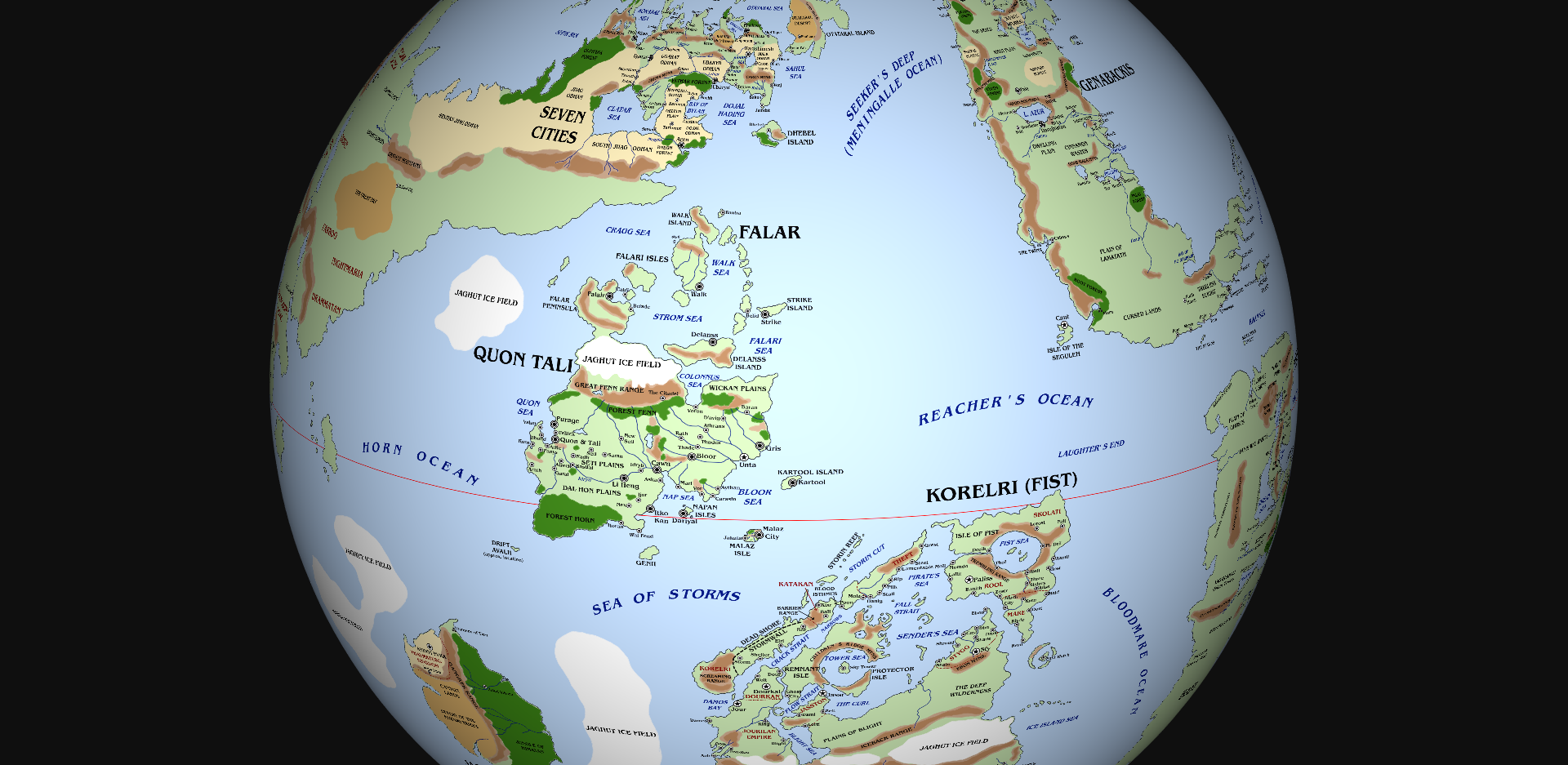
Genabackis is located east of Seven Cities, across Seeker’s Deep (known in Genabackis as the Meningalle Ocean); north-east of Quon Tali and Korelri, across the Reacher’s Ocean; north of Assail, across the Rivan Sea; and far to the north-west of Lether and the far western coast of Seven Cities, across the Rust and Domain Oceans.

Genabackis

A map of the continent of Genabackis. Some details are speculative. Please click for a larger version.

History

In ancient times, Genabackis saw mighty battles rage between the Jaghut, who had many redoubts on the continent, and the T’lan Imass. One of the most powerful and formidable of the Jaghut Tyrants, Raest, dwelt on this continent and exerted a reign of terror so devastating that other Jaghut allied with T’lan Imass to overthrow him. He was too powerful to be destroyed, so he was imprisoned by sorcery under the Gadrobi Hills of central Genabackis.

Numerous other wars between the Jaghut and Imass followed, until all of the Jaghut of Genabackis had (apparently) been utterly destroyed. The retreat of the glaciers from Genabackis (aside from the naturally-occurring ones at the far northern end of the continent) suggests that the Imass were more successful in their genocide of the Jaghut species on this continent than on Lether or Quon Tali, where many areas of impassable ice remain.

Even before the time of the Imass and Jaghust, Genabackis is believed to have been inhabited by the K’Chain Che’Malle. One of their cities was located in south-western Genabackis at Morn; a nearby Jaghut tower, although still ancient, is considerably younger in age than the ruined city.

Like almost all of the continents of the world, Genabackis was settled by human colonists from the First Empire of what is now Seven Cities. However, the collapse of the Empire seems to have led to the cutting of ties with Genabackis and the collapse of client-kingdoms on that landmass. There appears to have been an interregnum, during which time the humans of Genabackis became divided between tribal groups and villagers, before cities began rising to power again several thousand years ago.

The city of Darujhistan was founded on Genabackis in 837 Before Burn’s Sleep. It is believed that several cities predated Darujhistan, most notably Pale, whose immense foundations and subterranean levels of settlement hint at a history stretching back thousands of years earlier. Darujhistan developed gas power circa 263 Burn’s Sleep, marking the city’s growth in importance as a trading waystop between the densely-populated northern part of the continent and the sparser lands to the south.

In 1150 Burn’s Sleep, the mysterious Pannion Seer arrived at the city of Bastion, central-eastern Genabackis, and spoke the Words of Truth, resulting in the First Embrasure. The population of Bastion swore to follow the Seer, slaughtering a trade caravan from Elingarth in the far south of the continent. Nine months later Anaster, the First Child of the Dead Seed, was born.

The so-called Pannion Domin began to slowly expand, swallowing up surrounding villages and towns. It might be the informal alliance known as the Free Cities of Genabackis may have investigated this threat, if a much greater one had not suddenly burst upon them.

In 1152 Burn’s Sleep, the armies of the Malazan Empire invaded Genabackis. Malazan armies landed on the far north-western and north-eastern coasts, overrunning the areas around the Malyn and Owndos seas in a matter of months. The surprise attack saw the Malazans gain a formidable toehold upon the continent, but the Free Cities were quick to rally. They established mutual lines of support and defence and employed mercenary companies to bolster their own troops. The Malazans found their initial successes quickly bogging down into protracted sieges. The disappearance and apparent death of Emperor Kellanved in 1154 distracted the Malazans for a time.

In 1156, the Malazans signed a surprising formal alliance with the Moranth of western coastal Genabackis. The Moranth were motivated by centuries of feuding and skirmishing with the Free Cities, most notably Pale. The Malazans gained access to the advanced formidable Moranth munitions, chemical explosive weapons of tremendous power, which they were quick to exploit. This alliance led to significant victories, but three years later these reversed when the Free Cities allied with the Crimson Guard, the mercenaries commanded by Warlord Caladan Brood and the Tiste Andii of Moon’s Spawn under Anomander Rake, Son of Darkness. This powerful alliance pushed the Malazans back into Blackdog Forest, where fighting bogged down for the next four years.

In 1160 the Malazans sent reinforcements to Genabackis, beginning a siege of Pale itself in an attempt to split the attentions of the enemy. However, they failed and a protracted siege resulted.

As of 1163, the Siege of Pale continues but there are signs that it may be drawing to a close. The Malazan forces in northern Genabackis appear to have achieved some breakthroughs as well. If Anomander Rake and his allies can be defeated, the Malazans can turn their eye to storied Darujhistan. But there is also the growing threat of the Pannion Domin to the south-east, which has begun expanding and may soon threaten the entire continent.


Geography

Genabackis is a large continent, stretching from equatorial regions to the southern edge of the polar region, and is also relatively narrow. The continent as a whole is mostly temperate, with a warm southern coast and a cold northern one, with numerous lakes in the north (the remnants of vast glaciers which have since retreated) and larger plains in the south.


Northwest Genabackis

The northern tip of the Genabackan continent is dominated by the Malyn Mountains, a significant chain of towering peaks stretching from the shores of the Meningalle Ocean to Silver Lake. The range splinters around the Laederon Plateau, home of the feared Teblor tribes, who also dwell on the Teblor Tundra to the north.

South of these mountains lie the Malyn and Owndos Seas, large lakes whose shores are dotted with cities and towns like Malyntaeas, Bettrys, Blued and Owndos. These towns and cities, easily linked to the sea by the Treller Cut, have grown rich on trade with Seven Cities across the Meningalle Ocean to the west. However, this region’s accessibility made it ripe for conquest by the Malazan Empire, which has secured the region and installed their continental capital at Genabaris on the west coast.


Northeast Genabackis

Northeast Genabackis extends from the Owndos Sea to the shores of the Rust Ocean and south to the inland Lead Sea. This region, dominated by the rivers Gan, Gend and Sogen, is dominated by several major trading cities, including Sogena, One Eye Cat, Hoop, Evinor, Apple and, on its island off the coast, Horan, along with numerous small settlements on the Free City Plain, Stannis Plain and Harbinger Peninsula. This region was also invaded by the Malazans, but they faced stiffer resistance and the Free City Alliance was formed to fight against them. Over the course of almost a decade of warfare, most of the Free Cities have fallen, but a few carry on the fight with the help of Anomander Rake, Caladan Brook and other notable generals.


Western Genabackis

Western Genabackis has been the site of the heaviest fighting between the Malazans and their enemies. This region is dominated by plains, notably the fertile and verdant Reach in the north and the yellow-grassed Rhivi Plain to the south, the home of the nomadic Rhivi people. At the northern end of this region is the Blackdog Forest, a tangle of vine and roots where the Malazan army was bogged down for years of fierce fighting with the Mott Irregulars and Caladan Brood’s forces.

Most notable in this region is the western coastal area controlled by the Moranth. A reclusive and secretive people, the Moranth ended centuries of seclusion to unexpectedly ally with the Malazan Empire, ostensibly to take their revenge on the people of Pale whom they had skirmished with for generations. The Moranth have proved to be a formidable fighting force and their alchemical bombs, known as Moranth munitions, have proved to be an effective addition to the Malazan arsenal.

The Moranth territories include the Cloud Forest and Moranth Mountains extending as far north as the Mistral Plateau and as far south as Mengal. The city of Oach, on the coast to the west of the Mistral Plateau, has been conquered by the Malazans and was well-placed for trade and communication with the Moranth.


The Barghast and Bhederin

The Barghast are a formidable warrior culture of eastern Genabackis. A non-human species, they are seen as “exotic barbarians” by outsiders. Although a fiercely independent culture, they are also not scared of strangers and are noted for their humour, sense of honour and loyalty to their allies. The Barghast inhabit the Barghast Range of eastern Genabackis and the plains on either side. Their lands are largely barren and empty of resources, which is why they have endured for tens of thousands of years even in the face of “civilised” cities appearing on the coast to the north and south.

Species similar to the Barghast have been found on several continents, suggesting there was once a diaspora by sea. If so, the Barghast seem to have lost their ancient arts of boat-building and sailing.

West of the Barghast territories lies the Bhederin Plateau, home to the enormous creatures as Bhederin, which the Rhivi use for both food and occasionally mounts. The Bhederin are the descendants of a far larger, extinct species known as the Bhed, whose awe-inspiring remains have been found by explorers.


Central Genabackis

Central Genabackis is more sparsely-populated than the north, with larger areas of wilderness between settlements. Lake Azur, more of an inland sea than a lake, dominates this region.

The Free City of Pale sits just north of the lake and the Tahlyn Mountains, at the southern end of the Rhivi Plain. Pale is one of the most ancient and formidably-defended cities on the continent, noted for its massive curtain walls. The city is rich, with cobbled streets and well-tiled roofs. However, it is also arguably past its peak, with trade becoming more centralised in the north or in Darujhistan to the south. The Krael Quarter has become home to shanties and lean-tos inhabited by poor people and refugees. Pale has been besieged by the Malazan and Moranth armies for the past three years, further reducing its income and prospects.

To the south-east of Pale, beyond the Divide (a wide gap in the Tahlyn Mountains), lies a fertile region along the Rust Ocean which has been densely populated over the centuries. This region is dominated by the port cities of Capustan and Coral, with lesser cities such as Lest, Setta, and Maurik located between them. The River Catlin provides a means of trade and transport from Capustan to the interior, via the inland city of Saltoan. South-west of this region lies the heartland of the Pannion Domin, cities such as Bastion, Sarn and Ket Tor which have been avoided since the rise of the Pannion Seer.

South of Pale and west of Capustan lies Lake Azur, a vast inland waterway. Dotted around its shores and nearby are formidable settlements such as Dhavran, Kurl and Gredfallen, but most notable is storied Darujhistan, the blue jewel of Genabackis.


Darujhistan

Darujhistan, the City of Cities, City of Blue Fire or Caravan City, is located on the southern shore of Lake Azur ad is the largest and most influential city on the entire continent. During major festivals and the trading season, the city’s population exceeds 300,000 and may approach half a million; during the winter and off-season, the city’s population likely falls below a quarter of a million. Between 2,000 and 3,000 years old, Darujhistan accumulated from tribesfolk of the Gadrobi Hills and migratory Daru tribes from the far north of the continent. According to legend, the city was “born on a rumour”, with its founding following the arrival of thousands of explorers investigating reports of a magical barrow and treasure hoard in the nearby hills which was never found. However, several other valuable metals were found and quarries established nearby.

The city is divided into several areas, including the Gadrobi, Marsh, Daru, Lakefront and Estate districts. The city extends for over two miles along the lakeshore, rising into the Raven Hills to the south on four elevated tiers. The Foss River runs through the centre of the city, with the larger Maiten River flowing into Lake Azur to the west. Darujhistan also controls several outlying satellite villages, including Maiten, Cuttertown, Ridge, Raven, Urs and Worrytown, a slum region abutting the eastern walls.

Darujhistan is ruled by the Noble Council from Majesty Hall, located near High Gallows Hill at the north-eastern corner of the city. The enigmatic T’orrud Cabal and the secretive Assassin’s Guild also wield significant power. There is no standing army, only the City Watch, but several powerful mages reside in the city.

The city is sometimes called the “City of Blue Fire” for its use of natural gas for heat and light. Gas lamps light the major streets. The Greyfaces, a guild of gas-workers, tend the gas supply and make sure it is deployed in the city safely.

Darujhistan gains a great deal of its riches from its strategic position located almost halfway up the continent and marks a shift from the densely-populated northern part of Genabackis to the more sparsely-populated south.


The Southern Plains

South of Darujhistan are the Cinnamon Wastes and Dwelling Plain, which are now sparsely-populated. The Dwelling Plain was once thickly populated with towns and cities, linked by roads, but the region fell into disrepute when it was conquered by Jaghut Tyrants. When the last Tyrant fell, the region was abandoned and now only grasses and the occasional ruin remain.

Tracks lead far south and west, many hundreds of miles, to Callows, a great seaport of 30,000 people. Callows is well-placed on the sealanes heading south across Reacher’s Ocean to Quon Tali and the heartlands of the Malazan Empire. The city is known for its copper-domed buildings, minarets and winding streets, as well as being home to the Thousand Sects of D’rek.

East of Callows lies the vast Lamatath Plain. Almost spanning the continent coast to coast and extending from north to south for a thousand miles or more, the plain is reasonably fertile with occasional herds of Bhederin and other game easily found. Several tribes can be found living on the plain, including the Gandaru, Kindaru, Sinbarl and Skathani. From the etymology of the names, the Gandaru and Kindaru are likely descendants of the Daru people who migrated south from northern Genabackis to settle around Lake Azur, largely in Darujhistan. These groups probably migrated further south in search of less crowded climes.

Just south-west of the Lamatath Plain lies Morn, a once-great Jaghut city built about even more ancient K’Chain Che’Malle ruins. The area has been abandoned for centuries due to reports of magical chaos and dangerous phenomena in the area. The whole region is known as the Cursed Lands due to these events.


Southeastern Genabackis

East of the Cursed Lands and south-east of the Plain of Lamatath, the continent of Genabackis terminates in a peninsula extending for several hundred leagues eastwards into the Rust Ocean. There are a whole horde of coastal towns such as Ilem, March, Hurly and Torn in this region, but the best-known city is Elingarth, the largest city on the continent south of Darujhistan.

Elingarth is a large city renowned for its trading opportunities and religious orders. It is the home of the Grey Swords and Blue Shields, mercenary companies noted for their atypical honour and reliability in battle.

Nearby is the smaller city of Trygalle. Dedicated to trade even at extreme lengths, the city is the home of the Trygalle Trade Guild. The Trygalle Trade Guild, also known as “a guild of bloody lunatics”, use warrens to transport goods at high speed and ludicrous risk to distant locales. The Trade Guild’s services are almost ruinously expensive, but their reliability (despite a high personnel turnover) is surprisingly high.

Further west along the coast, in Elingarth’s Forgotten Holding, lies the town of Spendrugle, infamous for its bitter and angry rulers.

Further east lie the towns of Exile, Bounty, Golden and Refuge. Beyond the tip of the continent are the Night Ship Islands. Corpse Isle lies upon the edge of the unknown, the vast expanse of the Rust Ocean lying to the north-east and the Domain Ocean lying to the south-east. These oceans (counted by some cartographers as one vast ocean) extend east for thousands upon thousands of leagues before washing up against the far western coast of Seven Cities and the far north-west of little-known, rumoured Lether. Somewhere in this vast expanse lies the islands of Umryg and Genostel.

Just off the south coast, in the Rivan Sea, lies a series of islands such as Galatan and Seven Ruins Island. Some distance to the south, but too close for many, lies the forbidden and forbidding continent of Assail.


Seguleh

The Isle of the Seguleh lies just off the south-western coast of Genabackis, near Morn. The Seguleh are a highly martial people who live lives based on hierarchal rank, with elevation or descent in rank only achieved by combat. The Seguleh are trained from birth in the ways of battle and combat (individual and massed) and practice daily. The martial skill of the Seguleh, their utter lack of fear and their unrelenting intransigence make them an extremely difficult people to deal with for outsiders, and after far too many unintended deaths most outsiders now avoid the island and all contact altogether. As a result, little is known of the Seguleh aside from their martial skills and that their capital city, located on the northern coast of the island amidst green mountains, is called Cant.


People

The peoples of Genabackis are numerous and divided into many creeds. Genabackis is unusual in not harbouring large nation-states or kingdoms, instead favouring tribal groupings and individual city-states. The Genabackans thus have a reputation for independence and individuality, and do not take kindly to invaders.

The peoples of Genabackis include the tribal Teblor, Barghast, Rhivi and Gadrobi, the secretive Moranth and Seguleh and the urbanised Daru.


Credits: Based on the original maps created by Neil Gower. Extrapolated by D’rek at the Malazanempire forum. Placements and names adjusted by myself. Based on the Malazan Book of the Fallen series, Kharkanas Trilogy and Witness Trilogy by Steven Erikson, and the Malazan Empire and Path to Ascendancy series by Ian C. Esslemont.


Thank you for reading The Atlas of Ice and Fire. To help me provide better content, please consider contributing to my Patreon page and other funding methods, which will also get you exclusive content weeks before it goes live on my blogs.

Malazan Maps of the Fallen 03: Seven Cities

26 Tuesday Dec 2017

Posted by werthead in ian cameron esslemont, malazan, malazan atlas, steven erikson, Uncategorized

≈ 2 Comments

Seven Cities is, properly speaking, merely the north-eastern quarter or so of a much greater landmass that extends for many thousands of miles to the west and south. This continent is the largest in the world, and surprisingly one of the least well-known, for reasons that will become clearer. The name “Seven Cities” usually refers specifically to the eastern subcontinent, but is often used to refer to the entire landmass in lieu of any other name existing.

The Seven Cities continent is located north and west of Quon Tali, north of Jacuruku, west of Genabackis and north-east of Lether.

Seven Cities Subcontinent

The Seven Cities subcontinent. Please click for a larger version.

History

This continent is the home of one of the most ancient nations in the world. The First Empire of the Imass arose on the Seven Cities subcontinent over 300,000 years ago, but the Imass soon found themselves enslaved by the Jaghut Tyrants. Rebelling against the Tyrants, the Imass waged war against them only to find themselves stymied by the Jaghut mastery of the Warren of Ice and their willingness to simply sit out the conflict and wait for the much-shorter-lived Imass to die out. The majority of the Imass species underwent the Ritual of Tellann, becoming immortal in undeath so they could persecute their war against the Jaghut forever, if necessary.

As part of the ritual, the power of the T’lan Imass was placed in the First Throne of the Empire, allowing a mortal who could sit in that throne to order the T’lan Imass according to his or her design. The First Throne was hidden in a cave in the Jhag Odhan of southern Seven Cities.

Hundreds of thousands of years later, around 115,000 years before the present, the human First Empire took shape on Seven Cities. Dessimbelackis was a powerful sorcerer-king who rose to prominence after helping a human tribe defeat the Sar-Trell (modern Trell) in the Battle of Yath-Ghatan. The First Empire was declared (taking the name of the ancient Imass kingdom, to their irritation). The Empire expanded quickly, establishing seven major holy cities.

The First Empire spread all around the world, its fleets discovering six continents and eight hundred and eleven islands. Colonies were established on many of these landmasses, signifying the first major human diaspora. Of these the most successful was on the continent of Lether, with numerous kingdoms springing up from the initial First Empire colonisation wave.

Dessimbelackis ruled the Empire for several millennia thanks to sorcery. He delved deep into obscure and ancient rituals, possibly including Imass and Tiste sorcery, and he created the magical shapeshifters, the D’ivers and Soletaken. He also became a D’ivers himself, dividing his aspect between the seven Deragoth, the Hounds of Darkness. The result was a seething explosion of insanity, an entire city lost to Soletaken and D’ivers and the western part of the empire collapsing into civil war and chaos (out of which, many tens of thousands of years later, would emerge the forebears of the Perish, the Nemil and the Shal-Morzinn). The overseas colonies were cut off and collapsed, eventually recovering to found many of the human nations of the modern age. Only on remote Lether did they retain any memory of their link to the First Empire.

The T’lan Imass found Soletaken and D’ivers to be an abomination. They slaughtered them by the thousands, eventually destroying most of them. A few escaped, most notably the First Heroes: Treach, Ryllandaras and Messremb, among others. The other major survivors of the Empire were a religious sect, the Cult of the Nameless Ones. The Nameless Ones worshipped the Azathani, the bizarre and contradictory ancient powers, and their Azath Houses, those mysterious prisons dedicated to maintaining a balance of power in the world.

The Imass were wary of the Nameless Ones, fearing that they planned to find the First Throne and use it to compel the Imass to disperse or imprison themselves before their vengeance on the Jaghut could be completed. The Logros clan removed the First Throne southwards to Quon Tali, where they hid the throne in a subterranean crevasse. Centuries or millennia later, a great city was built over the site, further obscuring knowledge of the Throne’s location.

Eventually new human nations and cities arose in Seven Cities. The powerful Shal-Morzinn Empire took shape in the west of the continent, ruled by the sorcerer-kings known as the Three. North of their lands the Kingdom of Perish was founded, and to the north-east the kingdom of Nemil took shape. Nemil skirmished for many years with the Trell who lived to their north-east, eventually conquering them in a brutal campaign that reduced the Trell to a broken remnant of their proud past.

In the Seven Cities subcontinent, the Seven Holy Cities arose, each founded by an Ascendant, some in the days of the First Empire. The Seven Holy Cities were Aren, Ehrlitan, Karakarang, Karashimesh, Ubaryd, Ugarat and Yath Alban. Later other cities were given the title “holy city”, but they were of a lesser order to the Seven. These lesser holy cities were G’danisban, Hissar, Mersin, Pan’potsun, Lothal and Y’Ghatan. Each of the Seven Cities was ruled by a Holy Falah’d.

Unexpectedly, the subcontinent of Seven Cities was invaded from the south by the newly-founded Malazan Empire, only a few years after securing control of Quon Tali. Emperor Kellanved secured the port city of Aren first before moving across the landmass, taking city after city. A cabal of thirteen mages stood against him and was defeated, fleeing north. An elite Malazan unit led by the decorated soldier Whiskeyjack pursued them through the Pan’potsun Odhan and then into the Holy Desert of Raraku. There they defeated the thirteen mages. One of their number, Ben Adaephon Delat, was shocked by the unit’s survival and the changes wrought on it by the Holy Desert. He defected to the unit. Subsequently they became known as the Bridgeburners, having burned the bridges to their past. The unit went on to become a division, the Emperor’s favourites, and played a key role in the many wars to follow.

Seven Cities was integrated as part of the Malazan Empire, many of its people serving the Empire in military and sorcerous positions. However, Seven Cities never submitted fully to the yoke of foreign rule. In 1152-53 Burn’s Sleep, Barathol Mekhar slew the High Fist of Aren, who was ruling as a tyrant (and some say was planning to rebel against the Empire himself). Riots broke out in support of Barathol. During the chaos the Logros T’lan Imass were ordered to suppress the revolt with utter mercilessness. Thousands of civilians died in what became known as the Aren Revolt or Aren Massacre. Surly, later called Laseen, was held responsible for the overreaction and she was chastised by Dancer, to her fury. This massacre was one of the last times the T’lan Imass were deployed in battle on behalf of the Malazan Empire.

In recent times Seven Cities has been relatively quiet, but some crazed prophets warn of the Whirlwind, a rebellion against the Malazans to be led by the prophetess Sha’ik. These warnings have not been heeded, and indeed the Malazan Empire has denuded some of its strength in Seven Cities to reinforce the faltering campaign in Genabackis, leaving the strength of the Malazan position on the subcontinent dubious.


Geography

Despite its northerly latitude, Seven Cities is warm and hot (a phenomenon some ascribe to ancient sorcerous battles and others to the strange properties of nearby Otataral Island). Wastelands cover much of the subcontinent, along with vast, hot and barren plains called odhans. Only in the west of the subcontinent are there lots of trees, as the tall Olphara Mountains give rise to many lakes and rivers which run down the west coast, feeding the immense Olphara Forest.


Otataral Island

The enormous Otataral Island lies off the north-eastern coast of Seven Cities. The island is barren, dominated by the cold Bandiko Desert in the north and the warmer Otataral Desert in the south, separated by the sea and the wide-ranging Tano Hills, the home of the tribe of the same name. The only cities on the island are the small settlements of Dosin Pali in the south, Ruru Jelba in the centre and the larger Holy City of Karakarang in the north, along with Galladi on the island of Gallada just off the north-eastern coast.

Otataral Island is not a natural phenomenon. The desert of the same name is the source of the mineral also called otataral, a substance which can reduce the efficacy of sorcery and render it inert. The great Skullcup Mine makes a perfect prison for mages, as they cannot use their powers to escape or ferment dissent. Skullcup lies thirty leagues north of Dosin Pali, near a heavily-patrolled coastline. Prisoners seeking to escape Skullcup avoid the near coast, instead travelling north-west to the far western coast of the island, an invariably deadly trip of some ten days.

In the desert strange ruins have been reported, statues or parts of statues made of a mysterious jade-like substance. It has been suggested that these statues are the source of otataral, but the truth of the matter remains unknown.


Eastern Seven Cities

Eastern Seven Cities is densely populated, with numerous cities and towns lying on the coasts of the Otataral, Ehrlitan and Sahul seas, with many towns also dotting the shores of the inland Karas Sea. The Holy Cities of Ehrlitan, Karashimesh and Ubaryd lie in this region, along with the smaller but still important cities of Hissar (a major Malazan military centre), Sialk and Panpot’sun. In the west of this region lies the Holy Desert of Raraku. Although small, as these deserts go, Raraku is a strange place, possibly the bed of an ancient sea. Unusual things happen there and people try to avoid the area.

This region is dominated by numerous powerful tribes, most formidable among them the Gral of the Arifal Hills and the Tithan of the Tithansi Steppe.


The North Coast and Islands

The north coast of Seven Cities is fragmented and jumbled, with numerous peninsulas and headlands extending into the ocean and islands lying off the coast. The Holy City of Yath Alban is supreme in this region, but other major cities include Taxila, Karokitch, Hatra, Kot Ghul, Longshan and storied Y’Ghatan.


Central Seven Cities

The centre of the subcontinent is the home of hundreds of tribal groupings and isolated settlements, all surviving in the harsh heat. The Holy City of Ugarat is the largest city in this region but other major cities include Kayhum, Mersin, Omari, Sarpachiya, T’sarech and Nahal. The great Ugarat and Ubaryd Odhans sprawl across this region, their forbidding interiors home to fiercely independent tribes resistant to the idea of conquest.


Southern Seven Cities

Southern Seven Cities is that region squeezed between the large, inland Clatar Sea and the Dojal Hading Sea, an inlet of Seeker’s Deep. This area is bordered by the immense Vathar Forest to the north. To the south lies the River Menykh, at the mouth of which sits the Holy City of Aren. One of the largest cities on the subcontinent (and possibly the entire continent), Aren serves as the Malazan Imperial Capital on Seven Cities.

This region is otherwise dominated by plains and odhans, the most notable of which is the Khundryl Odhan in the north. The Khundryl are noted for their strength and ferocity in battle. The Burned Tears clan are the most well-known of the Khundryl tribes.

Off the coast lies Dhebel Island, a waystop and trading post for ships and merchants headed south to Quon Tali or east across the Deep to Genabackis.


The Jhag Odhan

The Jhag Odhan lies to the west of the Clatar Sea. It is immense, the largest odhan on the subcontinent, and is inhabited by various tribes. The Shena live on the north-eastern plain, close to the Clatar Sea and Shenohl Forest. Further west live tribes of Jhag and Trell, the latter refugees from the conquest of their ancestral lands by the Nemil. In the deep Odhan Jaghut used to dwell, until they were exterminated by the T’lan Imass.

A separate region of the Jhag Odhan runs south of the Clatar Sea. It is believed that the T’lan Imass First Throne used to exist in this region until it was moved to Quon Tali. The Nameless Ones, an ancient sect of the human First Empire, may still be active in this region as well.


Sepik

Sepik is a large island lying in the Dryjna Ocean west of northern Seven Cities. It was not part of the mainland Seven Cities culture, instead being an independent kingdom controlled by a hereditary monarchy. Sepik consists of two islands, Sepik proper and Monkan, and two distinct peoples, a ruling human class and the Rulhun’tal ven’or (or “Mudskin”) slave underclass, of Tiste Edur origin. Sepik is one of the most remote parts of the Malazan Empire, choosing subjugation over destruction during the conquest of Seven Cities.

Western Seven Cities Subcontinent

A highly speculative map of western Seven Cities. Click for a larger version.


Nemil and the Old Trell Lands

The south-western Jhag Odhan breaks up in a series of ridges and mountains which give rise to rivers and more fertile countryside. The Bayen Eckar River is a major feature of this region. The fertile plains on either side of the river were once the home of immense numbers of bhedrin, which in turn helped sustain the Trell people.

Some decades ago the Trell fought a long and bloody war against the Nemil, the people who lived to their south-west. Although winning many individual battles, they were powerless to resist the depopulation of their bhedrin herds by the Nemil and the cultural contamination of their young people being attracted to the cities. The Trell civilisation collapsed, subsumed by the Nemil with some survivors fleeing north and east into the Jhag Odhan.

The Kingdom of Nemil is militaristic and expansionist. Its capital city, Nemill, lies south of the Catal Sea and the kingdom itself covers several hundred miles. Nemil and the Malazan Empire have only had remote contacts, with Nemil aware that the much more powerful empire would crush it if it tried to expand into Seven Cities proper. Nemil has other powerful neighbours to the north-west and south-west which have, for now, checked its expansionist tendencies.


Perish

Perish is a vast, mountainous but remote peninsula which forms the western edge of the Catal Sea, north of Nemil. The Perish are an honourable people who believe in martial excellence and extol in the worship of various gods of war. The Perish also have powerful naval warships known as the Thrones of War. Although dedicated to honourable combat, the Perish have not fought a major campaign in centuries, aside from some minor skirmishes with Nemil to the south (which have left Nemil in no doubt of Perish superiority on the battlefield).


The Shal-Morzinn Empire

The Shal-Morzinn Empire covers much of the south-west of the continent. The Empire is large but thankfully non-expansionist: its three rulers are mage-kings of enormous sorcerous power who effortlessly put a Malazan scouting expedition to rout and ejected Kellanved and Dancer from their domain with no major effort. According to rumour, the Empire even resisted an assault by the Orshayn T’lan Imass and all but destroyed the invading army in the process (history does not record the reason for the enmity felt by the T’lan Imass to the Three). The Empire is ruled from the city or fortress known as the Spires, or Red Spires.

South of Shal-Morzinn lies the forbidding and hostile Demon Plain, where mercenary armies such as the Rams are known to operate. South of that lies a series of small towns and walled hamlets with names such as Glory and Piety.

Very little is known of Shal-Morzinn and the surrounding region, save that travellers, merchants and explorers avoid it.


The Cabal Archipelago

The remote Cabal Archipelago lies along a remote coast of the continent. The Cabal nation consists of the offshore islands and mainland holdings located hard against a towering mountain range. Cabal is ruled by a theocracy united in its worship of the One God (the powerful being known as Icarium).


People

Seven Cities is the largest continent in the world, divided into several distinct regions separated by mountains, deserts and plains. Its people are, unsurprisingly, hugely diverse. In Seven Cities proper large numbers of tribes live in close proximity to one another with very different ways of life and religious believes, leading to regimented and codified rules of engagement and warfare. The only thing that really unites these clans is their hatred of the invading Mezla, the Malazans.

There are non-humans living in Seven Cities as well: Tiste Edur in small numbers on Sepik Island, the Jhag of the deep odhan, the Trell, possibly even some T’lan Imass. Seven Cities is an ancient land that still hides many secrets.


Credits: Based on the original maps created by Neil Gower. Extrapolated by D’rek at the Malazanempire forum. Placements and names adjusted by myself. Based on the Malazan Book of the Fallen series, Kharkanas Trilogy and Witness Trilogy by Steven Erikson, and the Malazan Empire and Path to Ascendancy series by Ian C. Esslemont.


Thank you for reading The Atlas of Ice and Fire. To help me provide better content, please consider contributing to my Patreon page and other funding methods, which will also get you exclusive content weeks before it goes live on my blogs.

← Older posts

Patreon

You can follow me on Patreon to support my work here on Atlas of Ice & Fire and on The Wertzone.

PATREON

Follow me on Twitter

My Tweets

Donations

Donations to the Atlas of Ice and Fire help cover costs and support the site.

Please donate! This helps keep the site running without advertising.

Create a free website or blog at WordPress.com.

Privacy & Cookies: This site uses cookies. By continuing to use this website, you agree to their use.
To find out more, including how to control cookies, see here: Cookie Policy
  • Follow Following
    • Atlas of Ice and Fire
    • Join 294 other followers
    • Already have a WordPress.com account? Log in now.
    • Atlas of Ice and Fire
    • Customize
    • Follow Following
    • Sign up
    • Log in
    • Report this content
    • View site in Reader
    • Manage subscriptions
    • Collapse this bar
 

Loading Comments...